
How High Is Ijen Crater? Understanding Elevation and Trail Difficulty
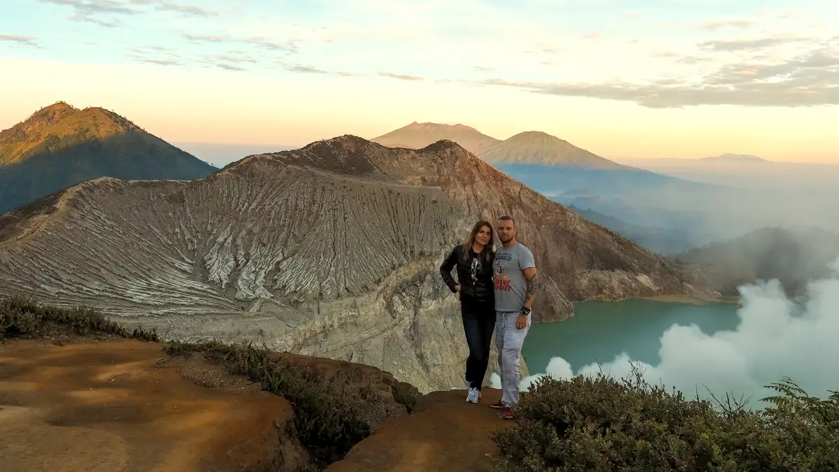
Key Takeaways:
- Summit Peak: 2,386 meters (7,828 ft).
- Basecamp Elevation (Paltuding): 1,850 meters (6,070 ft).
- Vertical Climb: 536 meters (1,758 ft).
- Average Temperature at Rim: 8°C to 12°C (46°F – 54°F).
About This Guide: Written by our Banyuwangi-based local operational team with first-hand field experience across East Java, including current trail conditions, departure timing, weather shifts, and real visitor logistics.
Table of Contents
What Is the Elevation of Ijen Crater?
When people ask “how high is Ijen?”, they’re usually looking for one of two numbers. The absolute summit of Mount Merapi (the highest point in the Ijen complex) stands at 2,800 meters. However, the spot where travelers stand to look at the blue fire and the lake—the crater rim—is 2,386 meters high.
It’s a significant altitude. Truth is, if you aren’t used to thin air, you’ll feel it in your lungs after the first twenty minutes of walking. The air up there is crisp and carries a heavy scent of sulfur. Understanding the distinction between Mount Ijen and Ijen Crater helps set the right expectations for your trek.
The Hike: Breaking Down the Vertical Gain
Here’s the deal: you don’t start from sea level. You’ll likely stay in Banyuwangi or Bondowoso before driving up to Paltuding. Paltuding is the official gateway, sitting at 1,850 meters. This means you’ve already done a lot of the “climbing” via car or scooter before you even lace up your boots.
From the parking lot, you have a 3-kilometer hike to reach the rim. While 536 meters of vertical gain might not sound like much on paper, the first 1.5 kilometers of the trail are quite steep. The incline is roughly 25 to 35 degrees in some sections. It’s a relentless upward push on a wide, sandy path.
Temperature Shifts at Altitude
As you gain elevation, the temperature drops fast. At the basecamp, it might feel chilly at 15°C. By the time you reach the summit rim at 2:00 AM, it’s common for the Ijen crater temperature to hover around 8°C. If there’s wind, the wind chill can make it feel closer to freezing. Wear layers; you’ll sweat on the way up and freeze once you stop moving at the top.
The Journey to the 2,386m Rim
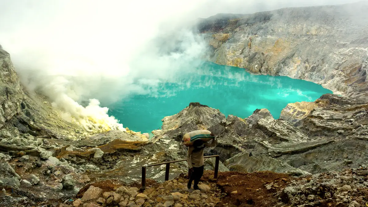
The trail is divided into three main sections. The first is the “Grind”—the steep sandy part. The second is the “Flat,” where the trail levels out near the weigh station (Pos Bunder). This is where the sulfur miners rest. The final section is a winding, gentle incline that leads you to the rim.
Honestly, the hiking difficulty is moderate. If you’re reasonably fit, you’ll reach the top in about 1.5 to 2 hours. If you’re struggling with the elevation or the incline, there are local “trolley taxis” (man-powered carts) that can pull you up for a fee. It’s a unique, albeit expensive, way to bypass the physical strain.
Descending into the Crater
Once you hit the rim at 2,386m, you aren’t at the end of the journey if you want to see the blue fire. You have to descend about 200 meters down a rocky, narrow path to reach the lake’s edge. This is where the acidic crater lake sits. It’s the lowest point of the active area, but still high above the surrounding valleys.
Practical Information
Preparing for this elevation requires more than just a pair of sneakers. Because the site is part of the Ijen volcanic complex, conditions change daily based on volcanic activity and weather.
- Location: Border of Banyuwangi and Bondowoso, East Java.
- Opening Hours: Usually 2:00 AM (check local alerts).
- Health Requirement: A medical certificate is mandatory for all hikers.
- Gear Needed: Gas mask, headlamp, warm jacket, and trekking shoes.
- Duration: 4-5 hours total (up and down).
Elevation Comparison: Java’s Famous Peaks
How does Ijen stack up against its neighbors? It’s a “mid-sized” volcano in the context of Indonesia, making it accessible for most travelers compared to the grueling climb of Mount Semeru.
| Volcano | Summit Elevation | Difficulty | Main Draw |
|---|---|---|---|
| Ijen Crater | 2,386m | Moderate | Blue Fire & Acid Lake |
| Mount Bromo | 2,329m | Easy | Sea of Sand & Sunrise |
| Mount Semeru | 3,676m | Hard | Java’s Highest Peak |
Local Tips You Should Know
Don’t just look at the numbers. The trail guide from our team suggests arriving at Paltuding by 1:00 AM to get your medical check done and be ready for the 2:00 AM opening. This ensures you reach the rim while it’s still dark enough to see the blue fire.
Also, remember that oxygen is thinner here. If you’ve just come from the beaches of Bali, your body might need a moment. Look, it’s not Everest, but the combination of sulfur gas and 2,300+ meters of elevation can make you lightheaded. Drink plenty of water and don’t be afraid to take breaks at the weigh station.
Frequently Asked Questions
Q: Is Ijen higher than Mount Bromo?
A: Yes, Ijen Crater’s rim is slightly higher at 2,386 meters compared to Bromo’s 2,329 meters. However, Bromo’s Penanjakan viewpoint is higher than Ijen’s rim.
Q: Do I need oxygen for the Ijen hike?
A: No, standard supplemental oxygen isn’t necessary for this height. However, a gas mask is mandatory to filter out toxic sulfur fumes near the crater.
Q: How long does it take to hike to the top?
A: For most people, it takes 1.5 to 2 hours of steady walking to cover the 3km trail to the rim.
Q: Can I see the blue fire from the rim elevation?
A: You can sometimes see a glow from the rim, but for the full experience, you must descend 200 meters inside the crater. This depends on safety status.
Q: What is the starting elevation for the hike?
A: The hike begins at Paltuding, which is 1,850 meters above sea level.
Recommended Tour Packages
Ready to see the height of Java’s beauty for yourself? Here are our top-rated Ijen Crater Tour options:
- Ijen Crater Tour from Bali – The most popular choice for travelers crossing the strait for a midnight adventure.
- Ijen Crater Tour from Banyuwangi (1 Day) – Perfect if you’re already staying in town and want a quick, professional guide.
- Bromo Ijen Tour from Bali 3D2N – The ultimate volcano circuit covering both of East Java’s iconic peaks.
- Ijen Crater Tour from Surabaya 2D1N – A great weekend escape from the city with all logistics handled.
- Bromo Ijen Tumpak Sewu Tour – For those who want volcanoes plus Indonesia’s most famous waterfall.
Final Takeaway
Understanding Ijen facts like its 2,386m elevation helps you pack the right clothes and prepare for the physical effort. It’s a manageable climb for most, providing one of the most otherworldly views on the planet. Just remember to respect the mountain, wear your mask, and take it one step at a time.
Planning Your Trip to East Java?
Explore our local tour options and choose a route that matches your travel schedule.
Planning to visit Ijen or Mount Bromo?
Explore available tour options and ask our local team about your itinerary.
Explore Tour Packages →